AREA 6: Ban Phe
BP06 Noong Xom
Before the village of Ban Cieng Puoc, leave the road to Dien Bien at
the cement factory and follow the valley up to the polje. After going 200m
north, the cave lies on the right side. After the entrance chamber, a meander
leads into the side of the valley, and can be followed Southeast. The cave
goes slightly uphill, narrows, and has some formations here and there.
A cleared blockage gave way to a few more meters to where the passage became
too narrow. This cave used to drain water from the hills to the valley,
but recently became inactive. The actual outlet might be found on a lower
level.
BP07 No Name
This cave has a beautiful entrance, and is well known by the local people.
It is located in a large doline, into which a little stream flows. One
side of this beautifully overgrown doline is very steep. It is in this
part that the large entrance opens into the cave. An inclined gallery can
be followed over large blocks and small cascades. The gallery ends in a
sump, which can be bypassed on the right side, but is immediately followed
by a second sump.
BP08 Tham Huoi Tap
Coming from Ban Lay, before the valley to Ban Vay, there is another
valley going Southeast. At the end one finds an artificial lake, used for
the irrigation of the rice fields. The entrance of the cave lies on the
Southeast side, about 40m above the lake. A short pitch leads into a canyon,
which was dry at that time, but the sedimentation shows that this is an
important drain during the rainy season (the villagers spoke about a roaring
sound). Upstream the canyon soon ends; it heads to the lake, but a passage
was not found. Upstream the aspect of the cave changes; the canyon turns
into a narrowing gallery, sometimes interrupted by small, beautiful chambers,
which goes slightly downhill. The bottom is covered by mud, sand and some
boulders. At the end, the gallery becomes impenetrable. The cave drains
the water from the hill to the valley (into the lake).
BP12 Water Cave
Just after the village of Ban Vay, next to the road, there's a resurgence,
being used as washing place. 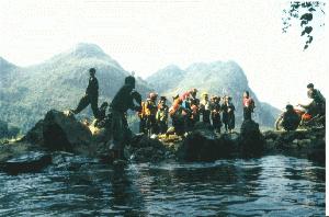 The
entrance of the cave is magnificent; the water is blue-green, and from
the inside, one can see the different entrances which light the lake. After
the lake, a meander is filled with water and requires swimming in most
parts (neoprene and life-jacket recommended). Close to the end of the cave
there are cascades in two shallow parts and a chamber with collapsed boulders.
The cave ends in a sump, where the gallery descends steeply. A side gallery
can be followed, which ascends, but soon becomes impenetrable. This active
cave has an important discharge and drains the hills of the area in the
southern part of the valley.
The
entrance of the cave is magnificent; the water is blue-green, and from
the inside, one can see the different entrances which light the lake. After
the lake, a meander is filled with water and requires swimming in most
parts (neoprene and life-jacket recommended). Close to the end of the cave
there are cascades in two shallow parts and a chamber with collapsed boulders.
The cave ends in a sump, where the gallery descends steeply. A side gallery
can be followed, which ascends, but soon becomes impenetrable. This active
cave has an important discharge and drains the hills of the area in the
southern part of the valley.
BP13 Tham Han
After a long search for an entrance to the underground Nam Muong system,
we finally found an access, about 15m above the valley bottom, where a
strong, hot, wet draft could be felt. There was no doubt about the connection
to the underground river. After descending 10m without equipment, a dry
room was reached, where continuation was found easily because of the strong
draft. A small inclined passage between formations gives way to a large
dry room. The floor consists of huge blocks, under which one can hear an
inlet of the high-volume river. Going down the room we reached the inlet,
but the room continues over 50 m, 10m above the inlet. The room turns 80°
to the NE, and 50m farther the river comes in. Several inlets come together
and form a river with a huge discharge. The river was followed North over
200m in a beautiful active joint with steep walls. A part of the river
disappears in a small fissure that becomes too narrow. To the left a horizontal
fissure goes to the east and after 50m the river is reached again. Here
one can observe interesting erosional phenomena, like solution pockets
more than 1m in diameter and depth. 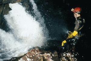 The
ceiling became low and we abandoned the river again. Approximately 40m
further, the river is met again by climbing down 4m. The cave becomes larger
again. At the left side a 10m waterfall comes in. A spectacular descent
near the waterfall became too dangerous. The wild river was followed about
10m higher in a horizontal fissure, where we went down to the river in
a joint (P10). Here, it disappears in another fissure, which becomes narrow
and choked with blocks. Up high we found a route behind a boulder, and
50m farther, after a descent, the river was found again. The gallery is
big and the ceiling is high at "Terminal Lake" where the river gets up
to 25m wide. About 60m further the ceiling comes down along a bedding plane.
In a small tube a siphon was found (no continuation without diving gear).
The
ceiling became low and we abandoned the river again. Approximately 40m
further, the river is met again by climbing down 4m. The cave becomes larger
again. At the left side a 10m waterfall comes in. A spectacular descent
near the waterfall became too dangerous. The wild river was followed about
10m higher in a horizontal fissure, where we went down to the river in
a joint (P10). Here, it disappears in another fissure, which becomes narrow
and choked with blocks. Up high we found a route behind a boulder, and
50m farther, after a descent, the river was found again. The gallery is
big and the ceiling is high at "Terminal Lake" where the river gets up
to 25m wide. About 60m further the ceiling comes down along a bedding plane.
In a small tube a siphon was found (no continuation without diving gear).
On our way back, a large sleeping snake was encountered. The hydrology
of the system is quite different from what we expected from the topographic
map. Only a little part of the incoming water is emerging to the north.
Indeed the discharge to the north is small with respect to the sink, a
dye trace will be needed. The cave turns to the east, into the mountain.
We searched for several days for an entrance to Tham Han behind the sump.
We believe Co Phai is a cave connected to the underground system.
BP14 Tham Met
Follow the big path from Ban Thum to the north. Over the hill take a
little path to the left next to a huge doline. About 150m further there
is a big entrance, 10m high and 30m wide. It is a big room, 20m deep, 40m
wide, and 10m high. The floor consists of blocks, with white formations.
BP16 Po Badin
We found this interesting cave while looking for an entrance to the
underground river of Tham Han. Above the resurgence of Tham Han take the
path to the right. The cave opens at the bottom of the second huge doline.
The entrance follows the bedding plane, dipping 50° to the south over
45m. It is followed by a vertical pitch of 15m ending on a platform. A
small hole leads to a 30m pit. We realised that we were at the ceiling
of a huge dry room (about 150m long, 50m wide). In the room we recognised
the bedding of an abandoned river. The river disappears into a muddy hole.
Many old formations could be found, covered with dry mud (guano?). At the
east side a small hole between formations was widened and a second chamber
(30 m) was entered, where a thick layer of guano covered the floor. First
we thought that we heard the sound of a river, but the noise was produced
by thousands of bats at the ceiling. At the north side a fossil inlet could
be followed over 40m, through the guano.
BP17 Huoi Nam Un 1
The entrance of the cave is located at about 200m downstream of the
probable resurgence of the Nam Muong river. Here, the river disappears
again. The entrance was found earlier, but was not entered because the
farmer told us the river flows just a few meters below the rice field and
resurges 200m farther...The entrance is 2m by 2m into which a river disappears.
The water is followed between trunks, a system of 14m is reached. In a
room two routes can be followed, the first is an inclined plane with a
pitch of 5m in a waterfall. In a little room the passage turns 90°
to the East, and some nice lakes with flowstone lead to a siphon lake,
which is beautifully decorated. The other passage is a conduit that follows
the bedding plane. After climbing down waterfalls of a few meters, with
deep circular lakes, a siphon is reached, but 30m back at the ceiling is
a gallery which passes the siphon. We continued about 40m more until a
second sump was reached. There might be a possibility of diving. As the
water levels of the sumps are at the same height, we think we reached the
level of the water table.
BP19 Resurgence
At this point the water of the Tham Han valley exits again. It can be
reached by climbing down a canyon. On the way, one can see that the karst
stops and is replaced by schist. The discharge of this river is much larger
than that of the river which disappears in Tham Han. The strange thing
is that the water seems to come from the Northwest, which means that the
water should make a sharp turn, at the contact with the schist, to the
Northwest, to resurge here, probably via another cave that drains the north-western
highland.
BPxx Co Phai
We found this cave while looking for an entrance to the underground
Nam Muong river. At the bottom of a doline, between blocks, a small fissure
goes down 10m at 60°. A squeeze was widened and a few meters farther
we passed another squeeze. After descending a few meters we entered a small
room, where a big boulder obstructs the way. A very strong, wet and hot
draft could be felt, making us believe that the cave is connected with
the underground Nam Moung river system. However, it will take several visits
to clear the obstruction, which might be interesting for the next expedition.
BP 20 Hau Lay
No description available yet.
BP 21 Hang Bun
Location: First wide doline at the right when descending into the valley.
In the doline there are 2 entrances. One of them is an evident sloping
P13 that emerges into a chamber and leads to the downstream part. A second
entrance through the blocks leads to the upstream part. A minor desobstruction
down the P13 was needed to connect the two parts. Downstream after a few
tens of meters an effluent enters the cave and it leads to a nearby doline,
through a clear fault. A traverse is possible. Upstream small galleries
(fracture) are alternated with wider chambers with formations and low passages.
The chambers and some flat passages contain quite a lot of mud (muddy mountain),
not yet fully dried up. The passage is interrupted by three dry V-shaped
siphons. A thick layer of pebbles follows each of the siphons. The third
siphon was completely dug out of the pebbles. Despite of the strong draft
we were bothered by a high CO2 percentage. After a long narrow fracture
we got to a larger part with soft mud. From a hole in the mud (50 by 50cm
and probably again a dry siphon) comes a strong draft. The hole has not
been checked because it seemed too muddy.