AREA 2: Nam Khum
Initially, the exploration of this area indicated a complex
aquatic system, with, most probably, the cave of Tham Ta Tong as
exsurgence. On the second expedition, the area between Nam Khum
and the polje of Ban Tham was explored extensively, in order to
unveil the missing trajectory of the 'Jan River' by finding new
accesses to it. Some were found indeed, but turned out to be
impenetrable or were ending at a sump. Two kilometres to the
North, another main drain was found, emerging , in the village of
Phieng Ngua, which unfortunately soon ends at a sump. It is clear
that further exploration of these systems cannot be done without
diving some of the many sumps that were encountered.
NK03 Hang Ran (Snake Cave)
This important cave was explored in 1993 and 1717m was
surveyed. We returned to investigate some points 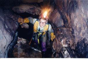 which were marked as
possible continuations.Using one 100m rope to descend the pitches
gived rapid access to the mainstream of the river. Upstream the
water-level was similar to that found in the previous
explorations; the cave ends at a sump at the same location as
found before. Downstream, the inlet coming from the north (which
joins the river at 500m from the pitches) was explored and
surveyed. A short climb over collapsed boulders emerges in a long
gallery, perfectly straight and horizontal (2m wide, 3m high), in
which one can easily progress upright. The bottom is covered by
cobbles and dried-up mud. At the end the gallery becomes very
muddy, till a small lake is reached, where the passage becomes
submerged. This sump cannot be passed without the appropriate
gear. It is obvious that this gallery becomes an important water-supply
to the mainstream in the rainy season.
which were marked as
possible continuations.Using one 100m rope to descend the pitches
gived rapid access to the mainstream of the river. Upstream the
water-level was similar to that found in the previous
explorations; the cave ends at a sump at the same location as
found before. Downstream, the inlet coming from the north (which
joins the river at 500m from the pitches) was explored and
surveyed. A short climb over collapsed boulders emerges in a long
gallery, perfectly straight and horizontal (2m wide, 3m high), in
which one can easily progress upright. The bottom is covered by
cobbles and dried-up mud. At the end the gallery becomes very
muddy, till a small lake is reached, where the passage becomes
submerged. This sump cannot be passed without the appropriate
gear. It is obvious that this gallery becomes an important water-supply
to the mainstream in the rainy season.
NK11 Tham ta Tong , Part II (the revenge)
This part had been surveyed during the previous expedition,
but the data of the part after the first sump had been lost.
After this sump, the cave widens and continues in the same way. 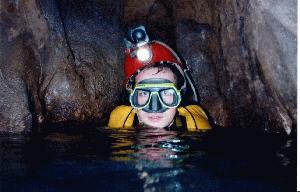 The South side is
particularly beautifully decorated with flowstone. Close to the
terminal sump the cave widens. There is a large muddy 'beach' in
which one sinks up to the waist! This is very close to the sump
of Nam Long.
The South side is
particularly beautifully decorated with flowstone. Close to the
terminal sump the cave widens. There is a large muddy 'beach' in
which one sinks up to the waist! This is very close to the sump
of Nam Long.
NK15 Cop Pop 2
In the valley leading from Son La to Kau Pha, near the village
of Phieng Ngua, there is an important resurgence. This resurgence
is impenetrable, but the people of the village showed us a small
entrance, some 150m to the NW and 40m up a hill. It was New Year
1996. Hot steam came out of a squeezy passage between blocks. The
squeeze is at the top of a 40m pitch! After some difficulties in
getting through with full SRT gear, we descended this pitch, and
entered a nice streamway at the bottom. It is definitely this
water that comes out at the resurgence. We could follow the river
some 200m upstream, through a very regular tubular gallery, to a
sump. In some parts, there are large mud banks, testifying to the
erosion on the surface. Downstream the river could be followed
about 100m to a sump which is probably close to the resurgence.
It would certainly be interesting to dive the upstream sump,
which is rather large. It has all the aspects of a main drain and
it is heading West, which is straight into the mountain.
NK18 Chien Le
Located behind the hotel up the mountain on a steep path.
Where the path turns to the right, continue climbing. The
entrance is a porch of about 4m high, followed by a little
chamber (5m wide, 7m long). The roof is a fissure of 12m high,
where daylight comes through. Climbing down between blocks (3m)
brings you to a little chamber where a meander starts (inclination
of 40°). We followed it for over 13m, descending to -8m. The
meander becomes too small. No continuation.
NK28 Tham Hoa
The local kids who lead us to the cave were really not
exaggerating when they told us about 'chambers as large as fields'
in this cave, on the ascending side of the steep shortcut track
to Ban Tham. A small boulder slope brings you into the entrance
chamber, from which there are three ways on. The right one, which
goes down about 12m below the entrance chamber, might be an
access to a lower level (At this point, we’re not far away
from the downstream sump of Hang Ran...). Only the middle way on
has a development of interest, heading towards the valley of Ban
Tham (Snake Cave). It enters a very old, large fossil cave with
white-grey coloured walls in which some passages are equipped
with bamboo. After the 'Grande Diaclase' (oriented south-west, as
usual) a natural bridge over a pitch brings you into a decorated
chamber with small, white 're-activated' child stalagmites
hanging onto their old, large, brownish bases. From here, the
river probably followed its way through a narrowing gallery which
is choked with mud at the end. A way up brings one to a narrow
passage which is followed by an old cascade. From here the aspect
of the cave changes; the gallery is more streamlined and the
walls have a rusty brown colour. There are some relatively young
stalagmites on the floor, underneath a drip of water. This small
area is the only wet part of this very dry cave. The passage now
follows the magnificent fossil river, sometimes more than 20m
wide. After about 100m, the gallery narrows and goes downhill to
the last big chamber, with a mud-covered floor and huge old
concretions. The way on narrows and suddenly stops in a passage
which is covered with mud. No way on was found here. Several
pitches were encountered and might lead to a lower level. The
ones near the narrow passage deserve attention.
NK30 Missing link
We found this cave when looking for entrances on the line
between Hang Ran (Snake Cave) and Nam Khum. The entrance lies
about 10m above the small, choked resurgence, which the villagers
use as a shower. According to local people the water comes from
Ban Tham and the cave would be 'very long'. The discharge is
small, compared to the Jan river in Snake Cave, so this might be
a side-branch of the main stream. The comfortable entrance gives
way to a remarkable turn in the river; downstream, the river
splits into different branches and flows between rocks and
concretions. At the end (20m from the entrance) the river
disappears between boulders (the inner side of the 'shower').
Upstream one can follow the shallow water with many deposits on
both banks. As the ceiling lowers, the water becomes deeper and
stagnant till a sump is reached, where the water seems to come
out of a mud-hill.
NK36 Lan Chon
Leaving Highway 6 to Ban Tham, take a right as soon as you
reach the polje, in the direction of the house at the south-eastern
end. From there, follow the path to the North, which goes over
the hill after about 600 m. The cave is located in a large doline,
filled with blocks and overgrown by vegetation. The first drop
descends over a series of blocks, and one arrives in the entrance
pitch (P10), which leads to a squeeze on the left side between
two blocks. Next is a P45, which is highly fractured and
beautifully decorated. A last descent from a natural bridge takes
you to the bottom, where you can follow a large gallery. On the
left side, there are several cracks, which lead to a lower level.
We went down the last one, which takes you down two little steps
(5 m) to the muddy lowest level, which is choked. We had to leave
the cave quickly because of CO2; the two blocks on top of the pit
prevent ventilation.
NK 41 Hay La Pho 2
NK 42 Hay La Pho 1
Follow Route No 6 from Son La up to the village of Dong Huy.
Take a steep path to the north, about 300m further, that brings
you to the polje of Ban Mot. At the southern end of the valley
there are two dolines in which both entrances are located. It is
clear that they drain the water during the rainy season. Hay La
Pho 1 starts with a boulder slope and develops against the
direction of the layers, towards the main valley, in which Route
No 6 is located. The cave stops at a very small passage, which is
choked. Hay La Pho 2 also starts in a doline, and has the same
depth. After a short boulder slope there is a short but beautiful
pitch. Each time the cave goes through a softer layer, it widens,
indicating that the cave is being formed by heavy water flows,
during the rainy season. The cave also ends at a choked narrow
passage.
NK 43 Tham Hiem
The cave is located in the same valley as the Hay La Pho caves.
Tham Hiem is a fossil chamber, with a flowstone cascade at the
end, which we did not climb due to lack of equipment. There is no
doubt that the cave continues there, but since the cave is
located quite high up the hill, it won't be very long. Graffiti
of people with helmets show that the army sheltered in this easy
and accessible cave during the war.
NK 38 Rung Ma (Phantom Forest)
The entrance is located near the top of a cone, just above the
local school and town hall of the village of Ban Hun. The
entrance (2 by 2m) is followed by a horizontal gallery which runs
gently upwards (80m estimated). From there on the roof becomes
low; we followed a crawl for 40m further. It stops, no interest.
NK40 Phieng Phe
Next to the road the cave opens with a small conduit (0.75 m
to 1 m width and 2 m high) which slopes down at 50° for about 50
m to -20 m. A draft comes out. We stopped at a little pit (5 m)
where nasty animals made continuation unpleasant. It might be
interesting to go back.